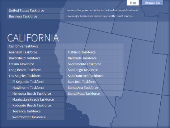
 A friend tipped me off to the liberally-licensed United States map in SVG format available at Wikimedia. I cleaned up the file a bit, changed a few things for my specific needs, and then set out building the ability to select a state to pull up a pop-over list of Taskforce sites.It probably took a total of 12 hours or so scattered over a bunch of days.I intend to write more about the technical details later. For now I just wanted to celebrate getting the new sites launched. I've been aiming to do that for some time but kept putting it off for myriad reasons. Glad to have it done.Check out the finished product.
2013-03-27
States and SVG
I finally launched a bunch of additional regional sites on my personal project, Brian's Taskforce. Several things needed to be adjusted to handle a wider spectrum of geography options.First, I removed a drop-down menu that allowed you to select a geography from a not-so-clever list. That simply would not scale to anything more than a dozen options.So like many sites that have geographic segmentation, I direct users to the home page to select a new region. Though, I admit that I would like to eventually build a dynamic overlay to select a new region without navigating to the home.The biggest change was giving users a visual means to navigate to their geography. A friend tipped me off to the liberally-licensed United States map in SVG format available at Wikimedia. I cleaned up the file a bit, changed a few things for my specific needs, and then set out building the ability to select a state to pull up a pop-over list of Taskforce sites.It probably took a total of 12 hours or so scattered over a bunch of days.I intend to write more about the technical details later. For now I just wanted to celebrate getting the new sites launched. I've been aiming to do that for some time but kept putting it off for myriad reasons. Glad to have it done.Check out the finished product.
 A friend tipped me off to the liberally-licensed United States map in SVG format available at Wikimedia. I cleaned up the file a bit, changed a few things for my specific needs, and then set out building the ability to select a state to pull up a pop-over list of Taskforce sites.It probably took a total of 12 hours or so scattered over a bunch of days.I intend to write more about the technical details later. For now I just wanted to celebrate getting the new sites launched. I've been aiming to do that for some time but kept putting it off for myriad reasons. Glad to have it done.Check out the finished product.
About this blog